South West Coast Path Walking
The South West Coast Path
The South West Coast Path
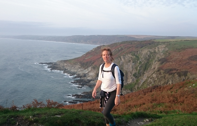
The South West Coast path has a long history and it’s 630 miles take in a huge variety of dramatic coast line ranging from high cliffs to huge sandy bays. In order to tackle walking this path planning is required and information given below we hope will help.

The History of The South West Coast Path
It’s origins date back to Tudor time (1588) when men were posted to the headlands all over the south west to look out for the approaching Spanish armada.
Import duties on traded goods (particularly brandy) caused a lot of smuggling to occur in the 18th and 19th century. To combat this in January 1822 a national force of “Coastguards” was created. Cottages were built around the coast and paths were necessary so coastguards could move along the coast checking on all the small coves and inlets. Smuggling in Devon and Cornwall was particularly strong so the coastguards were particularly numerous in these counties.
Gradually as smuggling was reduced the duties of the coastguard expanded to cover assistance to shipwrecked sailors and in 1856 the service was taken over by the admiralty and it no longer had any anti-smuggling duties.
All the parts of the coastal path were finally linked together in 1978. Coastguard cottages, the graves of drowned sailors and old smuggling caves can all be found today along the path and make up the rich tapestry of history that still surround this magnificent route.

The South West Coast Path of Today
The path is one of a family of “National Trails” and is well signposted using the symbol of the “Acorn”. It tries as far as possible to follow the coastline closely, but one should note that it takes in some high cliffs and walkers should take care. Local erosion sometimes causes small diversions inland and these should be followed.
The path starts in Somerset at the coastal town of Minehead and 630 miles later after taking in the entire coasts of Devon and Cornwall finishes in Poole in Dorset. The total amount of climb on the walk is 35,030m (115,000 feet) or the equivalent of walking up Scafel Pike (England’s highest mountain) 36 times!
For your average long distance walker a typical itinerary to complete the path would be about 50 days. The record (set by a runner not a walker) is 10 days, 15 hours and 18 minutes, by Damian Hall on the 24th May 2016.
To get an idea of really what it is like walking the path reading peoples walking blogs can be very informative. We have written up many of our walks along the path and see our “about” page.
Planning a Walk on the Path
When planning to walk the path one must make many decisions:
Carrying Kit or having it moved. Given the large amount of ups and downs on the path I would highly recommend having a bag transfered. It makes the walking experience a whole lot more enjoyable just carrying a light day bag with some snacks and waterproofs.

Accommodation
Bed and Breakfasts and Pubs with rooms: A warm dry bed each night and a hot breakfast each morning to set you on your way is very attractive option to many and there are many excellent bed and breakfasts all round the path. It is recommended to book ahead especially during peak holiday periods. Prices vary but double rooms with breakfast are generally available for less than £100 per night, some holiday hotspots will be more expensive.
Organising the itinerary yourself or having “Nearwater Walking” do it for you. If you have the time and the inclination it is perfectly possible to organise your itnerary and accommodation yourself, however why not rely on the experience and expertise of “Nearwater Walking Holidays” to do it all for you.
Cheaper Accommodation!
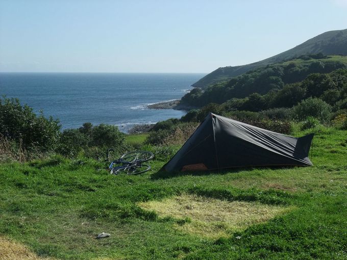
Camping: For the hardy or young athletic and underfunded taking a tent and camping can be great fun. There are some campsites around the path but not enough to be able to find one every night.
Wild camping is not strictly allowed as much of the path is owned by the National Trust who do not allow camping and in other parts it would be difficult to establish exactly who to owns it and therefore who to ask whether you can pitch your tent. Generally if you arrive late and find a quiet spot to pitch your tent and then leave early (leaving no trace) it is very likely that nobody will disturb you.
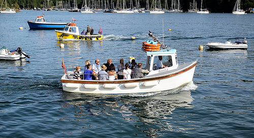
Estuary Crossings
There are many estuary crossings on the path and planning when to arrive at them is crucial for a smooth trip. Most are served by ferries, those that are not can only be crossed a few hours either side of low tide.
Detailed Information on Ferry Crossings.

When to Walk
The path can be walked throughout the year but some of the ferries only run Easter to October (see previous section). We would recommend May/June as the very best time to walk as the day’s are long, accommodation generally easily available and the spring flowers still in bloom.
